TAG :: Toronto Area Geocachers » Applications
Mar 16 2011

According to Engadget reports, those of you who bought the WiFi only iPad are not completely out of luck. Provided you’ve got an iPhone 4 running iOS 4.3, and your carrier allows Personal Hotspot.
While there are iPad devices with 3G Radios that can use location services, I’m referring to the less expensive version with no cellular capabilities. The GPS functionality on the iPad is provided by the 3G chipset – so if you have the WiFi iPad, you’ve no doubt realized how terrible location services that rely on WiFi triangulation can be – particularly in a place like Canada.
What the Engadget readers have noticed though is pretty cool if it’s true. Let’s say you bought the WiFi iPad because you already own an iPhone. Since last week’s iOS 4.3 update, you can skip the 3G on your iPad because of the new Personal Hotspot functionality. You can use your iPhone’s internet connection over Wifi from your iPad.
Here’s where it gets really cool: The iPhone is also sharing it’s location data with the iPad. As in the GPS chip data. So, if you want to go geocaching with a 9.7 inch display, you can. There are some problems with 3rd party applications using the location data, but that’s hit and miss. The Maps app works for sure, so worst case you can load up the cache in Geosphere and use it’s Show in Maps App function to get around that problem.
Just make sure you put an Otterbox Defender case on that iPad before you hit the Bruce Trail with it.
[ Engadget ]
Mar 15 2011

PiGo, our favourite iPhone app for visiting Wherigo caches (and Wherigo adventures) got a minor update last night. Notable improvements include auto-saving timing, and improved compatibility for cartridges. One of the fixes includes improved support for CurrentDistance and CurrentBearing functions [Source: Earwigo WWB Developer List]
[ PiGo (iTunes) ]
Mar 07 2011
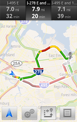
Google Maps Navigation Traffic Example (via Google Latlong)
Got an Android smartphone with Google Maps Navigation? Not only are you getting free turn by turn navigation software, but now that offering includes real time traffic – and auto routing around that traffic. Since Google offers traffic and Navigation in the Toronto area, this feature should be useful to more than a few of the local cachers here. The app will also take into account historical traffic – so it’ll know that the 410 is plugged on Monday mornings at 7:30AM for example. Of course that also means it’ll probably botch the traffic on Ontario’s new Family Day holiday too.
GPSTracklog points out on Twitter, this could also have the negative effect of creating even more situations where your GPS directs you into harm’s way.
[ Google Latlong Blog ] [ Google Mobile Announce (Twitter) ]
Feb 24 2011
![]()
Garmin’s OpenCaching.com site is nearing another milestone – the ability for third parts apps to edit (or delete!) geocaches and logs via the OpenCaching API.
If you’re just interested in geocaching, not writing apps, that’s pretty much all I need to say. The ability to edit logs on the fly is coming, and soon you will be able to log caches in the field without going to the web page.
If you’re a developer, this is where things get interesting. You will need to use OAuth for your app to gain access to the API. Garmin admits this is a tricky thing so they’ve set up a test server at test.opencaching.com. This is a spot where you can test writing data to the site without worrying about creating bogus data – they reset the site once a week actually.
To get started, you should take a look at the API documentation on OAuth, and make sure you have a developer key.
Thanks cachemania for the tip
[ OpenCaching API Write Access Announcement ]
Feb 16 2011
Mapquest has released a turn-by-turn navigation app for Android devices. There is also a slightly different iPhone and Blackberry product line, but this item deals with the Android version.
Mapquest for Android can also use OpenStreetMap data to boot, so you also get access to trails, traffic/police warnings and other user contributed data, and maps for international areas Mapquest doesn’t cover. If a street is missing, you can add it on the OpenStreetMap site.
While Android devices in the USA include free turn-by-turn navigation, international users (including Canadians) are often left out in the cold. The app is also useful if you travel to an area not covered by the built-in navigation app.
From the Android Marketplace Description:
FREE voice-guided, turn-by-turn navigation app for AndroidFEATURES:
• Absolutely FREE – There’s no trial period, subscription, or upgrade necessary. You get all these capabilities absolutely free!• Voice-Guided/Turn-by-Turn Navigation – Your phone speaks to you, telling you when to make a turn.
• Voice Search – Speak your destination or your search, for hands-free input.
• Place Map Toolbar – Look for restaurants, coffee shops, gas stations, etc. with one 1-click.
• Auto Re-route – If you take a wrong turn, it will your route will be automatically adjusted your route to get you to your destination.
• Walking & Driving Directions – Choose to walk or drive and we’ll give you the best route either way.
• Live Traffic Flow/Incidents – Extensive coverage that’s updated every 5 minutes, to help – to keep you on time.
• Map Rotates in Orientation of Travel – So your map is easier to read (with ability the option to lock to north up).
• Satellite Maps, CitySearch Reviews, and more!
• OpenStreetMap (OSM) Map Setting – User-sourced maps can provide unique local perspective and detail.
• Bug Logging for OSM – Standing in front of a new building? Report it to the community and they’ll fill in the missing pieces.
• Bug Logging for OSM – Identify trouble spots in the data for an enthusiast to update, improving the maps.
• International Maps – Automatic OSM maps for international users, so you can– allows users to take MapQuest abroad.
[ Mapquest for Android ] [ Mapquest 4 Mobile iPhone ] [ Mapquest 4 Mobile Blackberry ]
Feb 14 2011
Last week, Garmin issued an update to their Basecamp Product. This update addresses recent changes to the .LOC file format, and some bugfixes. Basecamp is a free product that works with Garmin’s line of GPS units.
- Added support for handling changes to LOC file format.
- Improved error handling for various map issues.
- Improved error handling for overlay issues.
- Changed default name of BirdsEye Imagery created from other user data to reflect name of selected item.
- Fixed issue where the basemap from the GPSMAP 78s was not displayed.
- Fixed issue where Topo Australia map was not displayed.
- Fixed issue where the Worldwide Aviation Basemap was not displayed correctly.
- Fixed issue with changing selection after removing waypoint from route.
- Fixed issue with deleting routes that span the Anti-Meridian.
[ Garmin Basecamp ]
Jan 25 2011

Back in December, Garmin launched that Opencaching.com listing service to compete with Geocaching.com. One of the big speculation items has been, would Garmin embrace non Garmin tech or would the site become just a marketing tool for Garmin products. Would they, for example, support smartphone users? Turns out, with that Opencaching API, Garmin doesn’t have to.
Enter “Cache Me”, by iTravel Tech. “Cache Me” is a free, third-party, geocaching application for Android and iPhone owners that provides listing information for up to 100 nearby geocaches. It was developed in under a month, which is much, much quicker than Groundspeak’s applictions for Geocaching.com. Note this app will ONLY interact with Opencaching.com, in fact it’s the first geocaching app I’ve seen that doesn’t try to use any data or service from Geocaching.com at all. t
The app shows how an open API can allow third party developers to improve the customer experience for the listing site, and how smaller developers can roll something out the door quickly. Cache Me is a “live data” application, and results are returned in realtime from the site. Being a full API application, there’s no need to scrape the Opencaching.com website and the result is a much faster experience than some other third party caching tools (and there’s no fear of user account bans either).
Some of the nice features that Cache Me delivers:
When you start the application, it immediately performs a search for nearby caches – up to 100 of them in version 1.4. The search took about 2 seconds to complete on my iPhone 4. You are presented a list but one finger tap and you can view them on a map instead. Pan the map anywhere, pinch to zoom in and out, or change the map from street to satellite or have a hybrid. Pan somewhere else and tap refresh if you want to recenter your search on another part of the map (road trip anyone?). Tap on a pin to see the cache description – the cache automatically becomes your target.


Once you select a cache, you will be presented with a summary screen. Here you can see who placed the cache, when (including the time!) and how it fares on the various Opencaching.com metrics – Awesomeness, Terrain, Size and Difficulty. Scroll the screen down and you will find the description text. At the bottom are options to view the hint, and up to 30 recent log entries.


The app does have some drawbacks, however.
Most noticable is the complete lack of tools for logging on site – there’s no log function within the app and I have not found an easy way to open that cache in the browser easily either.
The app does not feature any tools for handling puzzles or multi stage caches.
Still, the application was out the door 30 days after Opencaching.com launched. It’s under active development and more functionality is bound to be heading to the program. It will be interesting to see how this develops, and if it drives any innovation for the Groundspeak smartphone applications, or the Groundspeak API.
[ iTravel Tech ] [ Cache Me iTunes Link ] [ Cache Me Android ] [ Cache Me Facebook Page ]
Jan 21 2011

Garmin has released an update to their POI loader software for Windows. This software lets you take locations and add them as “Points of Interest” to compatible GPS units. Most modern Garmin devices support this feature. While these “Custom POI’s” are not editable on your device, it does allow you to load many, many more locations on the device than the Waypoints or Geocaches feature does. For example, in the image above I used POI loader to put 21,000 geocaches on my Nuvi 265. With this latest update, Garmin addresses a couple sore spots like file names and large GPX file loading problems.
[ Garmin POI Loader 2.60 ]
- Added ability to specify a custom POI file’s name
- Added ability to handle swapped lat and lon values in CSV files
- Fixed issue with multi-line CSV files not being read correctly
- Fixed issue with extended ASCII characters in CSV files
- Fixed issue with reading large gpx and csv files making the application unresponsive
Jan 18 2011
…. and the Geocaching.com update train keeps on rolling. This one is for geocachers who cache with a Windows Phone 7 device. This one is a little different – they updated the site instead of the App for these fixes, so you don’t need to run out and download anything.
The forum post says it all:
Bug Fixes:
* “Hide my finds” now only hides you’ve logged as “Found”.
* Log in issues have been corrected.
* Pocket Queries are working.
* Connection issues have been resolved.
* Archived caches no longer show up in searches.
Jan 17 2011
Here’s a little something we missed a few days ago (January 12th) – Groundspeak’s official Geocaching App for Android was updated to 1.1.3.
You can now upload photos with your logs and select motion based compass.
From the Geocaching.com forum post, here’s what changed:
Android v1.1.3 has been released!
New Features:
* Upload photos with logs.* Log manager to edit pending logs and view sent logs.
* Motion based compass is now an available option.
* Create, edit, delete, and select waypoints from the compass.
Bug Fixes:
* Fixed an issue that was causing erratic compass behavior.* Behind the scenes improvements.