TAG :: Toronto Area Geocachers » geocaching.com
Nov 16 2011
 Like many others, I’ve upgraded to GSAK version 8 and gave the new Geocaching API a try. At first I was really impressed.
I used the Get Logs function to grab the missing logs from my own caches so my stats page would be more accurate. Turns out, I missed several dozen logs by manually grabbing the GPX when people logged my caches.
I then played around with the Status Check function. This will be very useful before going caching in a specific area so that I don’t go looking for last minute disabled/archived caches.
A couple of days ago I took a look at the Get Geocaches screen. I normally use a bunch of Pocket Queries to fill my GSAK database, so I wasn’t expecting that feature to be too useful to me personally. One thing did catch my eye however. I noticed I can filter on favourite points. That would be very useful as I can’t do that with PQs yet.
So I set the minimum to 5 to get the more interesting caches. I also put in a maximum distance of 500km which is about as far I’m willing to go on a day trip. Then I hit OK. After it downloaded the data I noticed it only returned around 300 cache results. Odd, I expected a bit more. I then sorted by favorite points in GSAK and the cache with the most favorite points only had 140. That’s strange. I knew that the Earth Caches and Virtuals in Niagara Falls were between 150 to 200 points.
So I did a bit of searching on the GSAK forums and quickly found out what was going on. It turns out that there is a distance limit in the API. You’re limited to 50km radius if you specify a center point and 100km corner to corner if you specify a bounding box. I also found out that a warning was added in the latest GSAK patch regarding the limits:

That was rather disappointing. It pretty much makes the filtering useless. If someone wanted to find a Webcam for example they would be out of luck if there weren’t any within 50km of their search point. With a pocket query however they could select an origin of None and pick the States and Provinces they wanted to search. As long as they don’t search for something common that maxes out the PQ, they’ll get all the results in their search area.


If they wanted to search for something more common they can specify a search point and a limit of 800km (select 500 miles in the PQ). That’s 16 times greater range than the API allows. So for finding a certain type of cache Pocket Queries beat the API hands down.
This got me thinking. How useful would the API be for populating your GSAK database for day to day use. I did a search from my home coordinates and got around 4200 caches within 50km. That’s not bad at all. I filtered out my finds and still have 2100 caches to look for. That’s more that enough to keep the “close to home” cachers busy for a while.
I’m not a “close to home” cacher however. Over 40% of my finds are more than 50km away and 32% of my finds are 50 to 100km away which is only a 30 to 60 minute drive. I would have to do multiple API queries along the edge of the 50km radius circle to pick up those caches. That would give overlaps and holes in the coverage.
With Pocket Queries I have multiple queries set around my home coordinates with different place date ranges. In 2 days I can get all the unfound caches within 100km of my home. For the close to home cachers the API wins with it’s ease of use. For the cacher that likes to travel Pocket Queries are the way to go.
I started wondering, how would the 50km limit affect me if I lived somewhere outside the Golden Horseshoe. I did a 50km query centered on Owen Sound. I was expecting a couple of thousand caches but was surprised to only see 577 results. I then tried somewhere a bit more remote but still a large city. I did another 50km query centered on the City of Sudbury. I only got 506 results this time. And these are fairly large population centers. Small towns in Ontario’s north would get even worse results.
Using a Pocket Query you can get a 1000 caches easily. I tried one centered around Sudbury, and it stretched out to just over 100km from the search point to get them all. And this would expand out to the 800km limit as you find those caches and they’re excluded from the query. Pocket Queries seem to be the better choice for those outside of major urban areas.
As a comparison I tried the OpenCaching.com API to see what limits it had. Turns out it’s 5000 caches per request. I tried three requests centered on Mississauga, Owen Sound and Sudbury. Each time I received 5000 caches stretching out around 1200km from the search point.
For the close to home cachers in large urban areas the new Get Caches Geocaching API function in GSAK is all you really need. For those who like to cache in a large area or are in an area with a low cache density Pocket Queries would prove more useful. Those looking for specific types of caches will have to use Pocket Queries as the 50km radius limit doesn’t let you find much at all.
[ Geocaching Live API ] [ GSAK ] [ OpenCaching API ]
Nov 10 2011

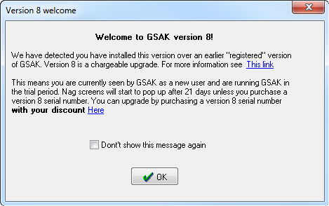
I’d heard there was a new version (8) of GSAK (Geocaching Swiss Army Knife) from many sources and was actually excited to be able to hand Clyde an extra $20 to upgrade from my registered version 7. There are some new features worth the upgrade, not the least of which is the Geocaching.com API.
After installing the new version, I had no idea what the limits were so I went looking for the app. It’s found in the new “Geocaching.com access” tab right next to help. If you click on “Get Geocaches” it will bring you to the window where you can define things much like you can in pocket queries. The basic tab is where you define a center point, distance, max geocaches to get, # of favorite points, size, difficulty and terrain. The advanced tab allows you to choose cache types, hidden by, found by, exclude by and even lets you define a box with top left coords and bottom right coords.
Then the fun began. The window started with a very small amount of caches to get but I thought they set the bar way to low at 30 caches. To find out what it could handle I plugged in 5000 and let it rip. Did it come back and tell me I was out of my mind? Too big a number to grab all at once? Nope. It started plugging away at them 30 caches at a time. Tick-tock went the clock and within 10-15 minutes I was up to 3500 caches! Way cool! Then it happened, I don’t know exactly what but it stopped and froze GSAK. I waited for about 5-10 minutes and then…GSAK came back and showed it was processing the files. When all was said and done I’d managed to download 3558 caches. Not quite the 5000 I was hoping for but considering this version of GSAK had just been released I suspect many might have been trying the same thing. Another way of looking at it, with this one app I was able to get all the caches from Milton to Clarinton, Kawartha Lakes to Tiffin and the south end of Barrie to Toronto with everything in between. Now if only I could fit them on my Colorado all at once!
When GSAK finished it’s processing it showed a screen similar to the one you get after loading a Pocket Query. In that I found Geocaching.com has set limits on the amount of caches one can load using the geocaching.com API. It seems the 5000 it put in was not to far off as the DAILY LIMIT is 6000 caches. The best part is that it also loaded the favorite points for each cache, something that didn’t come through on my last PQ. In order to view them as part of the list, you’ll need to click the “View” tab and click on “Add/Remove Columns”.

Other popular items included in the “Geocaching.com Access” tab include Refresh Cache Data, Download Pocket Queries (No need to go to the site to download those ready to go PQ’s), Get Logs (you set the amount per cache), Status Check (archived, Disabled, Enabled), Publish Logs, and Add to Bookmark List.
[ GSAK ] [ Geocaching Live API ]
Nov 09 2011

Clyde has just released the newest iteration of GSAK – The Geocaching Swiss Army Knife. This is the de facto geocaching utility for cachers with access to a Windows computer. The product enables cachers to keep track of geocaches, waypoints, logs and their geocaching statistics in an offline database. This can be used for purposes like custom loading GPS units or running various macros against the data.
This version adds support for the Geocaching.com “Live” API (as hinted in yesterday’s release notes). This lets your macros access data direct from Groundspeak without packaging it in a Pocket Query first. There are more updates, but you can find all the nuts and bolts in the release notes.
Note this is not a free upgrade. Depending on when you purchased GSAK v7 (or v6) your upgrade price ranges from $25 to $5.
[ GSAK ] [ GSAK v8 Release Notes ]
Nov 08 2011
Another little tidbit came out of today’s update at Geocaching.com. You can edit/nuke an image that someone uploads with their log entry.
That means you can remove spoiler pictures without deleting the actual log entry.
For example, here’s a log on my cache – GC2DN1K Leaf Peeper Leap, by cache4pat. This one I just chose at random from my owned caches.
Before today, I could view the image. If I wanted to remove it, I had to delete the find log.
Today, I have a new “Edit Image” option when I view that log as the cache owner.

Once I click on that “Edit Image” button, I have the familiar screen as if I owned that image. I can change the title or delete it altogether.

Now I’m not actually going to change this log entry, I just pulled it as an example to show that it can be done now. This is a great feature (that should be used with care) that puzzle owners can use to remove spoiler images without affecting the finder’s find count / log order.
Nov 08 2011

The maintenance mode banner is back on the Geocaching.com site
Geocaching.com has gone down for it’s monthly maintenance update, and it’s usual host of bug fixes. Notable this month are new Geocaching Live! partners (namely GSAK) and corrected coordinates for Mystery and Multi-Caches.
That last one is what has me paying attention – the feature has been one that geocachers have waited about 10 years for. You can adjust co-ordinates for a mystery you have solved or a multi you have finished so the cache will reflect the actual co-ordinates. You can download them in individual GPX files from the cache page but not from Pocket Queries just yet. While this will wreck havoc on GSAK databases in the short term, cachers without GSAK (for example, Apple Mac owning cachers) now have a way to load corrected co-ordinates in their GPS without having to fire up GSAK in Windows Virtual Machine.
Other updates today, as posted by OpinioNate:
Release Notes:
• Added a feature to correct Multi and Mystery cache coordinates for personal use (note: Coordinates are fixed in individual GPX downloads however Pocket Query functionality will follow in another release) • Added the ability for cache owners to delete spoiler log images without also deleting the log text • Added GSAK, Sachsencacher.de, GeoGet and Cachebox to list of partner applications on geocaching.com/live • When a geocache is created or edited we now associate (behind the scenes) a Yahoo GeoPlanet WOEID to the cache allowing us to tap into 6 million named places globally. This provides opportunities to expose the data in creative and helpful ways • Separated out Challenge stats to a new profile tab and added the ability to view a user’s Challenges completed and created, as well as your own accepted • Avatars are now resized to 48 x 48, down from 75 x 75 • Added Romanian to the list of Geocaching.com supported languages • Added new French translation of the Intro to Geocaching presentation at geocaching.com/tools/intro.aspx • Updated site-down notice with Facebook link and “hamster” video • When viewing a bookmark list you own it is now possible to see which caches in the list you have already found • Transitioning away from User Voice and back to IPB forums for support inquiries and feedback • Fixed map bug which caused the map not to update a Pocket Query properly when making changes to the PQ • Fixed map bug which caused the mouse pointer to identify filtered caches by name even when the icon is hidden • Fixed display of updated coordinates log in print-friendly version of cache pages to actually include the new coordinates • Updated text for Discovering a trackable on the Travel Bug tutorial page • Added clarification to Terms of Use, Section 3 (language now allows for under-18 usage of the website with parent or guardian supervision) • Fixed the CITO gallery to include a log link when viewing an image • Fixed link on /about/history.aspx page to updated noaa.gov description of Selective Availability • Added new teaser video for “Discover” challenge type on types page
• Fixed display issue on Trackables pages when the title is especially long
Geocaching Live API Beta
The beta launch of the Geocaching Live API continues! This time we’re pleased to announce four new partners:
Geocaching Swiss Army Knife (Coming Soon)
This application will scheduled to launch with Live support tomorrow. GSAK is the all-in-one Geocaching and waypoint management tool. Features include: Groundspeak API support, multiple databases, sending/receiving waypoints to GPSr, Google maps, conversion to many mapping formats, PDA output (including CacheMate support), HTML output, extensive searching, macro support, and much more. GSAK runs on Windows operating systems (2000, XP, Vista, Windows 7).
GeoGet
A complete geocaching solution for Windows. Import Pocket Queries, solve mystery caches, add notes, plan trips, and export information to the GPS or browse your database in your PDA.
CacheBox
Cachebox is a paperless mobile geocaching software for Android with offline database support and Geocaching.com Live API capability. Manage and find mystery caches with intelligent handling of Final Waypoints and the Mystery-Solver module. Features include multi-database support, image and spoiler view, Field Notes upload, track recording and viewing. Cachebox is a free open-source application.
Sachsencacher.de
Sachsencacher.de is a website providing statistical evaluation of geocache quality in Saxony (Germany) by examining log content.
[ Geocaching.com ] [ Release Notes ] [ GSAK ]
Nov 08 2011

Today there has been a mass-archiving/disabling of geocaches along the Bruce Trail near Orangeville. Normally this wouldn’t be something to write up an article on a geocaching site, but there is an interesting twist to the story. TheCarterFamily has removed several geocaches placed along the trail, with log entries that it was at the request of the Bruce Trail Conservacy. Here’s a couple of the caches that have been disabled:
On GC1202G Elbow:
I’ve been asked by the Bruce trail to remove all my caches on the Bruce Trails. If anyone is in this area can you pick up the cache. Might be a while before I can get to this one.
On GC117QV Hockley Valley Book Exchange
I’ve been asked by the Bruce trail to remove all my caches on the Bruce Trails.
Now that you’ve got your eyebrows up, I do have to mention a few things. First off, Groundspeak isn’t acting here – it’s the cache owner pulling their caches. Also, this is at the moment localized to Orangeville/Hockley Valley – this may be just the Caledon Bruce Trail Club or Dufferin Highlands Bruce Trail clubs that are pursuing this course of action. Finally, I do need to mention that as far as Groundspeak has been concerned in the past, it’s the property owner who holds the authority here, not a trail association. Hockley Valley Book Exchange, for example, is on Ontario Parks property, not Bruce Trail property. While the Conservacy does hold large tracts of land along the trail, they don’t own all of it so a blanket ban on caches along the Bruce Trail is not exactly an automatic thing.
The Bruce Trail is one of the most popular geocaching destinations in southern Ontario. There’s even a recurring event cache that has a group of cachers hiking the entire length of the trail. To lose caching on that 800+km long trail (with at least that many caches along it) would certainly hurt geocaching around here, but don’t panic just yet. This person who contacted TheCarterFamily may not even be an official with the Bruce Trail – that sort of thing has already happened on other trail systems where a muggle or geo-hater pretends to be an official and sends out cease-and-decist type emails.
When I’ve had discussions with the Bruce Trail Conservacy they were actually quite positive about geocaches along their trail. There are actually several promotions that the club has been using to encourage trail use, including a geocaching like “spot the heritage tree” challenge and side trail quests with prizes where hikers hike along looking for signs with numbers on them.
When in doubt, contact your local reviewer for information. Forward the land-owner’s email to your reviewer so they can verify the validity of the claim and also to update listing guidelines in the area if a change has, in fact, occurred.
[ Bruce Trail Conservacy ]
Oct 31 2011

Friday night, Cachedrone made an interesting post in the Groundspeak Forums – “Testing in Ontario: Organized Group Hunts“.
The text of his post reads:
Recently the reviewers of Ontario approached Groundspeak with a request. We asked if Ontario could be used for a two month period to test the idea of allowing an Event to be listed for the sole purpose of group caching (organized cache hunt). We are pleased to announce that they agreed. For the months of November and December it will be possible to create an Event Cache to simply go geocaching. We are very interested to see what the community creates during this period and how these events are received. This test is exclusive to Ontario and will end on the 31st of December. We may have to limit the number of group hunt events that are listed in any given area. With the exception of allowing group hunts, all other guidelines still apply to the review process, like the 14 days advance notice. It should go without saying that each of these events, the logs posted on them and any forum feedback will be tracked for discussion with Groundspeak at the end of the test. This should be viewed as a one-time opportunity to explore a new way to be social with fellow geocachers on the trail and not an indicator or future developments. We look forward to this study and your feedback.
If you have questions about this you can reply within this forum thread or email me directly at [email protected]
What does this mean, exactly? Well, it means that for two months – November and December 2011 the rules regarding event caches are being tweaked in Ontario, Canada as an experiment. Normally a geocaching event must be a social activity that is more than just a group of people going geocaching together. This is to prevent people from listing an event every time they go caching with friends (overwhelming the event listings).
Now, these organized cache hunts can be listed as an event. That means activities like the Ottawa GeoMob’s weekly breakfast, or the BFL Crew’s friday night get togethers could conceivably be listed as events. More likely, gatherings like the massive GHMGC organized cache hunts that occur monthly will be listed as a monthly get together.
It will be interesting to see how this turns out. It could mean a new social dynamic with regular caching events bringing more cachers together. Or it could mean losing sight of the big events like Spring Fling / GHAGAFAP, as the events are drowned out by a sea of “Lamp Post Micro Events”
Is this another quantity over quality concession from Groundspeak – power trails for event cachers? Time will tell – at the end of the day, how Ontario geocachers respond to this experiment could define the future of events for everyone.
Events still need to be listed 14 days in advance, and the reviewers will be limiting the number of events in the same area if necessary. Events that are posted will be analyzed by Groundspeak. The experiment ends December 31,2011.
[ Groundspeak Forum Thread ]
Oct 22 2011
![]()
My how BFL Boot Camp has grown. The first year, we hid 6 geocaches and they were mainly based on the use of firetacks. The event “Fall Back to Night Caching” (archived – Geocaching login required) had 38 teams attend, and was organized by 5 people. At the time, we figured it would be a one time event.
Fast forward to 2011, and we are hosting the 6th iteration of this annual event. We’re looking forward to seeing 200 people attend this year, with over a dozen caches hidden for it. We have 20 people helping out on the organizing committee. The caches now feature lasers, UV paint, glow in the dark features, and more. Gone are the days of a simple follow the firetack to the tupperware type cache hunt. Over the years, the BFL Crew has hidden over 50 night caches in North Halton. Two of the original hides are still active – GCYPW9 The Circle, and GCYXNJ What Bugs You in the Night.
The event caught the attention of Groundspeak this week, and they have posted an article on the official Geocaching Blog – “Latitude 47” about the event. The article, titled “Geocaching in the Dark: The Great Canadian Night Caching Event” appeared on the blog Friday evening. Featuring information about night caching, our event and even some photos from past year’s events.
This year, the night caching event portion starts at 2130h and, while the even officially ends at 0400h, often there are attendees still out well past that time. We look forward to seeing you at the event on Saturday, October 29th.
[ BFL Boot Camp VI – Retro Reflect ] [ Latitude 47 ]
Oct 11 2011

Here’s a disturbing new development for geocaching in Canada. The Ministry of Transportation has banned geocaching on their property. That’s all highways, roads, rest stops, guardrails and more. Anything posted within 100 metres of a road, or MoT structure is going to be declined by the reviewers for the time being. This one’s going to affect a LOT of geocaches in British Columbia.
From the Groundspeak Forums, cachers who have caches placed within 100M get the following reviewer note:
Due to a recent complaint by the British Columbia Ministry of Transportation, Groundspeak has asked that no roadside geocaches be published at this time. This means no caches by a highway, road, lane, pullout, intersection, traffic circle, median, highway rest stop, boulevard or any land or equipment that may be remotely considered owned or maintained by the Ministry of Transportation. There is a huge grey area here as the Ministry of Transportation has not yet told Groundspeak exactly which land they consider their right of way. Because of this, we must err on the side of caution.
This is not to say that your cache can never be published. The people at Groundspeak headquarters are working with the Ministry of Transportation to hopefully bring this debate to a satisfactory conclusion for everyone involved. I understand your frustration but please be advised that this is out of the reviewer’s control. Everyone concerned is frustrated.
You have the option to move your cache to another area well away from any road or you may wait until the matter is settled. If you choose to wait, be advised that it is the government we’re dealing with and there may not be any settlement for a very long time.
I’m temporarily disabling your cache to give you the option to move far from any road. If you do move it, please feel free to click the enable link by the top right corner of the cache page to submit your cache to the reviewer’s queue once again.
Now the argument could be made that micros along roadways aren’t the top of the quality scale but this does affect more than the roadside power trails. 100 metres extends a fair amount into most parks and private properties too. This wipes out the concept of hiding a cache on your own property if you live in a typical suburban lot, as your entire property is usually within 100 metres of the road in front of your house. The loss of the “highway rest stop” cache is also a painful one as many geocachers will use the rest stops with caches to break up a long trip.
The BC reviewers are working with the Ministry of Transportation to clear up exactly where to draw the boundary lines and such, and perhaps even repeal this new restriction but for now, be warned that since it’s the Government they are dealing with, this could take a while (see: Ontario Parks). So far, this is a Groundspeak restriction – no word on if they have contacted other listing sites just yet.
Here’s hoping the Ministry of Transportation of Ontario doesn’t send any similar messages to Groundspeak. For now, watch the thread on the Groundspeak Forums, or perhaps the British Columbia Geocaching Association for developments.
[ GC Forum Thread ] [ BCGA ]
Sep 01 2011

Well, Waterloo Region had their GPS Adventures Maze Exhibit, and Alberta had theirs. Now, it’s Toronto’s turn!
The GPS Maze Exhibit is an interactive display about geocaching put together by Groundspeak, Minotaur Mazes and Trimble Navigation. The travelling exhibit features a 2,500 square foot maze with interactive experiences that teach about GPS technology and, of course, geocaching. The Waterloo Maze exhibit was clearly American oriented but this time (the rumours say) it will be the redesigned Canadian specific version that debuted in Alberta this summer.
The exhibit will run at the Ontario Science Centre from October 2, 2011 through January 8, 2012. There is an admission fee for the Science Centre but it’s a really cool place to explore in addition to the Maze Exhibit.
Also, just like they did in Waterloo, Groundspeak will host a Geocaching Event complete with a Lackey (Eric) on opening day. The event runs from 11AM to 2PM on October 2.
[ GC33AVY – GPS Adventures Maze Exhibit Event ] [ GC32XHM GPS Adventures Exhibit ]