TAG :: Toronto Area Geocachers » 2011 » March
Mar 30 2011
 Garmin has released a beta version of it’s Basecamp for Mac software. The list of changes is a doozy – they have been busy at Garmin! Notable improvements are aimed at geocache handling and BirdsEye. Note that BirdsEye may not work 100% for the beta just yet.
Information below is from the Garmin Basecamp for Mac Beta website:
as of March 29, 2011
Download(66.78 MB)
View installation instructions
Notes:
- BaseCamp is a 3D mapping application that allows you to transfer Garmin Custom Maps, BirdsEye Imagery, waypoints, tracks, and routes between your Mac and Garmin device. It allows you to manage your data on practically all Garmin map products, but topographic maps are required for 3-D rendering.
- Features include:
Transfer waypoints, geocaches, routes, and tracks to and from your GPS device. Create, view, edit, and organize waypoints, routes, and tracks. Find places, such as addresses, points of interest, and public land survey areas included in your detailed map data. Download, display, and transfer BirdsEye imagery to supported devices. Import, display and transfer Garmin Custom Maps to supported devices. Track Draw Printing the map, driving directions, and route and track profiles View in Google Earth Advanced geocache support Geotagging photos Photo waypoints Integrated support for publishing photos online Track and route play back
Exchange custom waypoint symbols with selected devices
- System Requirements:
Intel based Mac running OS 10.5.8 or higher. Tiger and PowerPC users should use BaseCamp 2.1.2 available here.
1024 MB RAM (2048 MB recommended)- Warning: This beta is English-only and won’t run in other languages. If you are not running your Mac in English, don’t install this beta.
- Although this software is believed to be reliable, it has not yet been released for production and should be used at your own risk.
- General:
- Added Activity-based profiles. This allows the user to have different route and map settings for different activities.
- Added ability to back up and restore user data
- Added heart rate and cadence to the track dialog
- Added the ability to export GDB files
- Added analytics to collect application usage statistics
- Removed ability to display marine maps in deference to the release of HomePort
- Folder improvements:
- Added folders and subfolders to allow organization of lists
- Add ability to sort user data by date in addition to the current name, type
- Map improvements:
- Added Overview mini map, accessible under the View menu.
- Added tips to the tool pop up about moving waypoints or shaping a route.
- Added ability to configure which map features (POIs and lines) to show or hide.
- Added ability to configure the POI icon size
- Added ability to configure the number of labels that are displayed on the map
- Improved 3-D view to hide features that are behind terrain.
- Improved geocache support:
- Added ability to configure what is displayed for geocaches on the map: Symbol, Symbol and Id, or Symbol and name. Use the context menu to change settings for more than one at a time.
- Added support for Opencaching.com geocaches
- Added searching for Opencaching.com geocaches
- Added the ability to set the z-order (draw order) of BirdsEye and Garmin custom maps. Note this will only work with new BirdsEye images downloaded for devices with the latest beta firmware.
- Improved the ability to track the found status for geocaches
- Added the ability to read the geocache visit status from supported GPSs.
- Added the ability to automatically log found geocaches to Opencaching.com
- Added a new smart list criteria for geocache find status
- Improved import of geocaches from a GPX file
- Fixes:
- Fixed issue where quitting the application while reading a map from card could cause a crash
- Fixed issue where disconnecting a device while it was being read could cause a crash
- Fixed rare issue where clicking on the 3-D map with the routing tool could cause a crash
- Known issues:
- Find is not finished. As such, there is no way to turn finding of Opencaching.com geocaches off.
- Though your previous data will be preserved, this installer will overwrite your old version of BaseCamp. If you want to revert to the released version of BaseCamp, download and install BaseCamp from our web or the Mac App Store and your old data will be available.
- Since BaseCamp beta uses different BirdsEye servers, that functionality will not be immediately available while using the beta. This will hopefully be rectified in the future.
[ Basecamp for Mac (Beta) ]
Mar 27 2011
 Here’s an interesting Head’s Up from Greywynd. Parks Canada is planning a Geocaching event along the Trent-Severn waterway on July 16. We don’t have much details at this point, other than a “mark the date”. It’s great to see some Parks Canada love for Central Ontario after the geocaching love seen in the Atlantic Provinces (Fundy NP, Louisbourg NP, Cape Breton Highlands NP) and more recently British Colombia (Gulf Islands NP) has been getting some official Parks Canada geocache support. Oh, and this one could be featuring the Passport idea where you visit caches, get stamps and earn a geocoin for your efforts too.
So, if you can be in the Peterborough area on July 16, make a point to come on out and show Parks Canada that we love caching in Ontario’s National Parks too.
Mar 17 2011
Garmin has posted a batch of beta firmware downloads for their current outdoor product line. This affects the GPSMAP 62, GPSMAP 78, Oregon and Dakota lines. The updates are pretty much identical across the board, fixing GPS performance, JNX (Bird’s Eye) handling and a few crash bugs.
Please remember these are beta releases so while you are getting new features and fixes, there is nothing to say your GPS won’t do weird things after loading this software.
GPSMAP 62/78 2.93 Beta:
- Improved GPS performance
- Improved JNX file handling
- Increased maximum number of supported JNX files to 250 from 200
- Fixed shutdown when unit had more than the maximum number of JNX files on it
- Fixed shutdown related to topographical maps and land cover text size
- Fixed Glide Ratio to Destination field
- Fixed problem with profiles and the fields on the map page
- Problems with the software may be reported to [email protected]
Oregon 200/300/400 4.16 Beta:
- Improved GPS performance
- Improved JNX file handling
- Improved the usability of the main menu setup page
- Increased maximum number of supported JNX files to 250 from 200
- Fixed shutdown when unit had more than the maximum number of JNX files on it
- Fixed shutdown related to topographical maps and land cover text size
- Fixed shutdown associated with certain custom POI files
- Fixed Glide Ratio to Destination field
- Fixed an issue related to adding a geocache as a point in a route
- Problems with the software may be reported to [email protected]
Oregon x50 v4.45 Beta:
Changes made from version 4.32 to 4.45:
* Improved GPS performance * Improved JNX file handling * Improved the usability of the main menu setup page * Increased maximum number of supported JNX files to 250 from 200 * Fixed shutdown when more than the maximum number of JNX files were present * Fixed ‘Search Near’ functionality on Hunt & Fish and Sun & Moon pages * Fixed shutdown related to topographical maps and land cover text size * Fixed shutdown associated with certain custom POI files * Fixed Glide Ratio to Destination field
* Fixed problem with profiles and the fields on the map page
Dakota 4.01 Beta:
- Improved GPS performance
- Improved JNX file handling
- Improved the usability of the main menu setup page
- Increased maximum number of supported JNX files to 250 from 200
- Fixed shutdown when unit had more than the maximum number of JNX files on it
- Fixed shutdown related to topographical maps and land cover text size
- Fixed shutdown associated with certain custom POI files
- Fixed Glide Ratio to Destination field
- Fixed issue with profiles and the fields on the map page
- Problems with the software may be reported to [email protected]
Update: Added Oregon x50 series Beta
Mar 16 2011

According to Engadget reports, those of you who bought the WiFi only iPad are not completely out of luck. Provided you’ve got an iPhone 4 running iOS 4.3, and your carrier allows Personal Hotspot.
While there are iPad devices with 3G Radios that can use location services, I’m referring to the less expensive version with no cellular capabilities. The GPS functionality on the iPad is provided by the 3G chipset – so if you have the WiFi iPad, you’ve no doubt realized how terrible location services that rely on WiFi triangulation can be – particularly in a place like Canada.
What the Engadget readers have noticed though is pretty cool if it’s true. Let’s say you bought the WiFi iPad because you already own an iPhone. Since last week’s iOS 4.3 update, you can skip the 3G on your iPad because of the new Personal Hotspot functionality. You can use your iPhone’s internet connection over Wifi from your iPad.
Here’s where it gets really cool: The iPhone is also sharing it’s location data with the iPad. As in the GPS chip data. So, if you want to go geocaching with a 9.7 inch display, you can. There are some problems with 3rd party applications using the location data, but that’s hit and miss. The Maps app works for sure, so worst case you can load up the cache in Geosphere and use it’s Show in Maps App function to get around that problem.
Just make sure you put an Otterbox Defender case on that iPad before you hit the Bruce Trail with it.
[ Engadget ]
Mar 16 2011

Dale Atkin (Ibycus) has posted on the Groundspeak Forums, indicating that the newest release of his free (Garmin) topo map project for Canada is now ready. The new release features improvements for road features, particularly in Quebec and a newer version of the underlying topo data.
Just a quick note here to say that I’ve *finally* finished work on version 4.0 of the maps.
This version includes new roads for much of the country (including Quebec, which hadn’t been updated since the maps came up), as well as more areas with road names.
Also there is a new version of the underlying dataset for the topo data.
Finally included are what I *hope* are all of the more minor roads that disappeared between version 2.1 and 3.0. These are included as a transparent overlay that can be added to the maps (or any map for that matter).
I hope to get the torrent of the PC version going tonight.
Just a reminder, we have a Pro Tip posted for installing version 3 on our site. Version 4 should follow the same instructions.
You can obtain the map data using BitTorrent, here’s the tracker file. If you’re security minded, the MD5 SUM is also available for the Torrent:
MD5 Sum – 3ddd5edfaf793f9cadc6f449ec6d55e4 *IbycusTopo40.iso
[ Ibycus Topo 4.0 (BitTorrent) ] [ Ibycus Topo Home ]
Mar 15 2011

ElectroQTed’s GPS as seen on TheRecord.com
Ted Spieker, a.k.a. ElectroQTed has been featured in an article by Matthew McCarthy about his geocaching adventures in the Waterloo Region Record’s “People of Record” section. The article is a black and white photo/video presentation where Ted is speaking as the narrative voice. It’s a great listen, and the photos are wonderful, showing numerous night caching aventures.
Way to go Ted!
[ Ted Spieker – People of Record ]
Mar 15 2011

PiGo, our favourite iPhone app for visiting Wherigo caches (and Wherigo adventures) got a minor update last night. Notable improvements include auto-saving timing, and improved compatibility for cartridges. One of the fixes includes improved support for CurrentDistance and CurrentBearing functions [Source: Earwigo WWB Developer List]
[ PiGo (iTunes) ]
Mar 08 2011

Well, after a few months of huge, earth shattering changes at Groundspeak’s Geocaching.com site, we are treated to a March update that’s in like a lamb. This month, the devs have “circled around” to patch up some bugs, and add a bit of marketing material to the site.
They added some video clips to the site under the “videos” tab, and they have added a handy-dandy intro to geocaching presentation that can be downloaded for your group’s next Geocaching 101 event. Note they don’t want people modifying that presentation except to add/remove their organization’s logo or drop the video.
Another useful feature is that your stored (not active) Pocket Queries increases from 40 to 1,000. That should cover just about anyone – particularly those of you who make PQs for common tasks/trips that you don’t run weekly.
Some of the other updates include:
24401: Move Lost & Found videos onto a new video page
Added new Video page and link in left-hand navigation23911: Adding Norwegian Bokmal to geocaching.com
Added translations24829: Adding Estonian Language to geocaching.com
Added translations25140: Default map view is home location, if set
Beta map will now default to home coordinates or Seattle if not chosen25229: Remove inactive PQ limitation from PQ Page
Increased maximum saved PQs to 100023026: Addition of “Intro to Geocaching” Presentation to Resources Section
Download a slide presentation for use when teaching others about Geocaching25244: Create Counties for Hungary
Added 19 counties including the capitol
[ March 2011 Release Notes (Groundspeak Forums) ]
Mar 07 2011
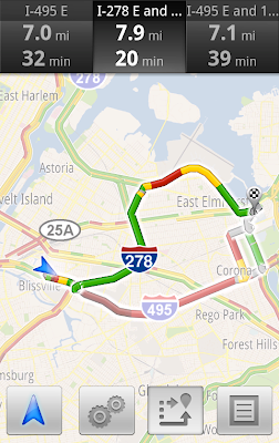
Google Maps Navigation Traffic Example (via Google Latlong)
Got an Android smartphone with Google Maps Navigation? Not only are you getting free turn by turn navigation software, but now that offering includes real time traffic – and auto routing around that traffic. Since Google offers traffic and Navigation in the Toronto area, this feature should be useful to more than a few of the local cachers here. The app will also take into account historical traffic – so it’ll know that the 410 is plugged on Monday mornings at 7:30AM for example. Of course that also means it’ll probably botch the traffic on Ontario’s new Family Day holiday too.
GPSTracklog points out on Twitter, this could also have the negative effect of creating even more situations where your GPS directs you into harm’s way.
[ Google Latlong Blog ] [ Google Mobile Announce (Twitter) ]
Mar 04 2011
Another day, and another person has been led into harm’s way by their GPS. The story is continuously repeating itself in the news – a person sets up a street routing GPS and follows it’s directions, even if that route is not the best idea. While map errors do occur, particularly in the more remote parts of Canada, often the GPS is doing exactly what it has been told to do.
When you ask your GPS to find a route to a destination, it does not know what the best route to take is. Typically the GPS units are set for “Fastest Route” or “Shortest Distance”. Quite literally, that is how the GPS will pick roads to get you there – all it is concerned with is the road segment length and the speed limits set on those roads. It does not know that a logging road is impassible by a two wheel drive family sedan in the middle of winter. It doesn’t know what the ferry schedules are, or that the ferry is closed until ice-out.
Now, the easy way to avoid this problem is to instruct your GPS that you’d rather it avoid certain situations. Modern GPS units have all kinds of crazy cool route avoidance features but I’m going to concentrate here on the simple route avoidances that should be in just about every GPS.
To avoid logging roads in the winter, you can disable “Unpaved Roads”. While this will remove most of the problem spots, you still need to pay attention to where you are driving. If the road is even making you slightly uncomfortable turn around and go back the way you came. If you are driving in an unfamiliar area, this is double important. Do not drive on roads that are beyond your capabilities, be that vehicle or driver.
For example, to avoid Unpaved Roads on a Nuvi 2xx series (should apply to others)
Go to settings …
 Then go to Navigation …

Now, here’s where it’s less intuitive. Select Avoidances (even if it already says “Enabled”) and that will bring up the menu ….

Here, you can disable Unpaved Roads (Particularly useful outside major urban centres, like Northern Ontario). You can also set it to avoid toll roads like the 407. One small warning though if you’re planning a trip to the USA – the bridges along the Great Lakes in places like Niagara and Windsor are toll bridges. I’ve had my GPS try to route me from Toronto to Rochester via Kingston when I’ve had Toll Roads disabled. I almost always leave U-Turns disabled so my GPS isn’t constantly telling me to “Turn around when possible”. In Toronto, it’s usually a better idea to go around the block.

Once you’re done picking what you’d rather avoid – you need to restart any driving instructions you have already started so the avoidances will take effect.
If you have a different GPS type, the info to avoid things should be right there in the manual. The capabilities to do this vary by unit (for example, Navigon on iPhone can’t disable unpaved roads). The key is to learn what you can or cannot do, and use that.